|
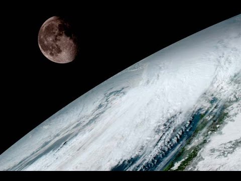
The first set of images from the GOES-16 satellite have been released by National Oceanic and Atmospheric Administration (N0AA). The geostationary satellite will be used for weather forecasting, severe storm tracking and more.
Views:
8172
Playlists:
0
Downloads:
0
Date:
2017-03-06 13:50:00
|